Sunday, October 4, 2015

A Fine Finish

Day 16: Grosmont to Robin Hood's Bay
Miles today: 14.05
Total miles: 218.75
Total steps C2C: 507,677

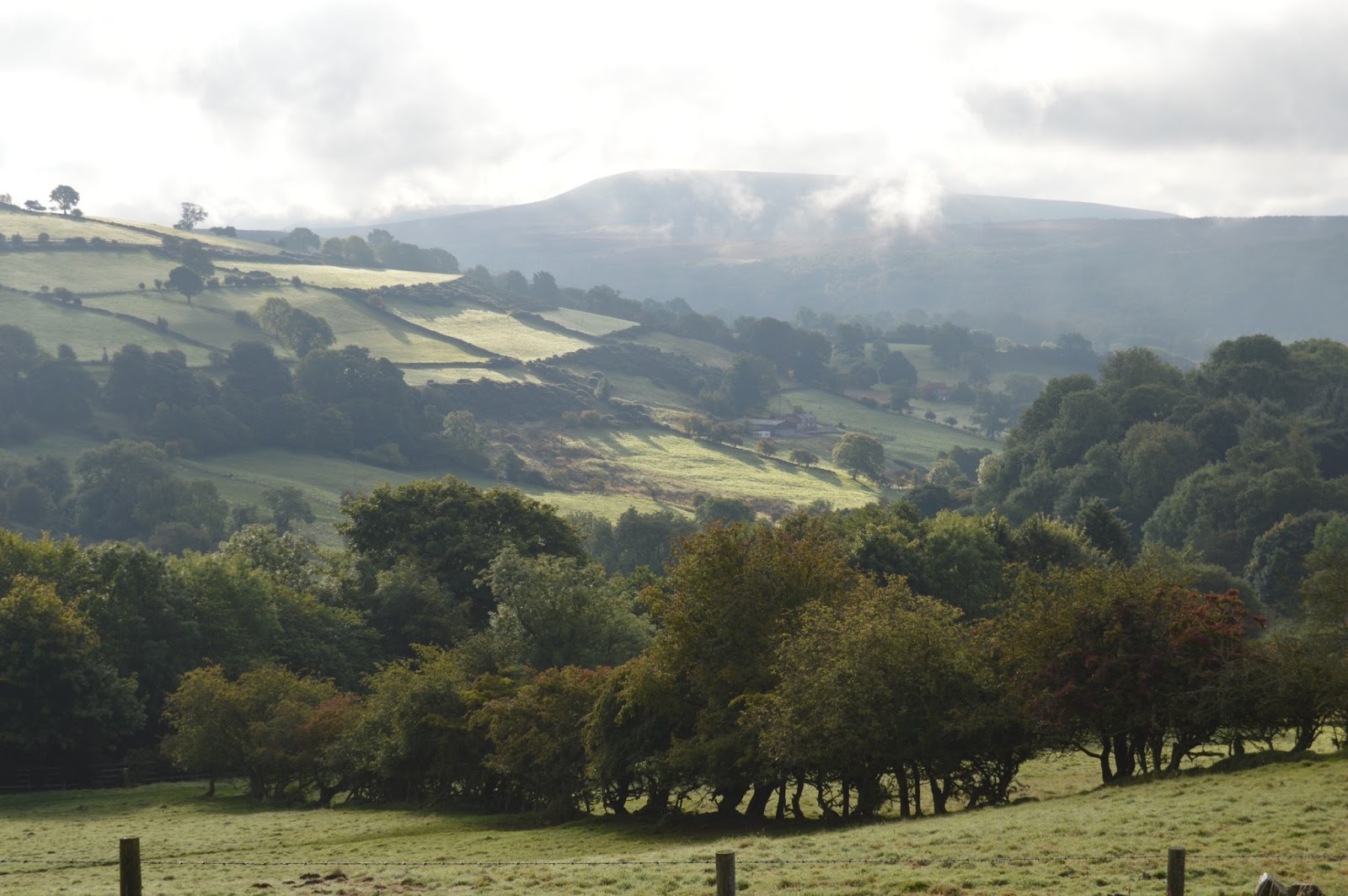
If anyone is considering walking the C2C, I would suggest doing the last leg of it from Grosmont to Robin Hood's Bay to see if this kind of walk is for you.

It is a taste of everything the route has to offer starting with a 30 degree grade climb. It then moves into a gorgeous forest and nature preserve along the River Esk in Littlebeck, followed by pasture paths that are quite boggy (only ankle deep though!) and onto a country road. Then you see the true essence of the C2C; a road sign that says Robin Hood's Bay 3-1/2 miles--but you don't take that way. You get off the road and walk a circuitous six mile path along the coast. Wainwright was never about the direct route!

We were more than ready for this journey to end so we cut the walk short and took the road. We were keeping with the spirit of the C2C and one of the reasons the trail is not way-marked. Wainwright wanted people to make their own paths across the country. So we took the liberty and the straight track to the end!

After arriving in RHB, we stopped by the B & B to drop off our backpacks before going down the very steep hill to the sea. We dropped the stones we'd carried all the way across from the Irish Sea then dipped our boots in the water. It was pretty emotional and we were excited to be finished.

Following tradition, we walked up to Wainwright's Bar and signed the logbook of finishers. We were happy to see that our trail friends Mark and David and also Ed and Andy had signed before us. Too bad we didn't all get there together. It would have made it extra special. After a pint of Wainwright ale, we walked back up one more steep, steep hill for a nap before dinner.


Saturday, October 3, 2015

Another Foggy Day

Day 15: Blakey Ridge to Grosmont
Miles today: 14.29
Total mileage: 204.69

Today was one of the few days that didn't start with a climb uphill. We were already at a high elevation. We're only a few miles fom the sea, but still have over 30 miles to walk. As we've learned, Wainwright never took the direct route when a diversion of a few miles might have a view of something interesting. Sadly, today our views were once again obscured by fog. It felt like we were walking in a tunnel.


One good thing is that we're heading back into civilization. It was three days ago in Osmotherley that we last saw a shop of any kind. Jim came down with a cold and our goal today is to get to Grosmont before the Village Co-op closes so he can get some medication.

As we got lower, the fog lifted a bit but we had missed our chance to view the sea. Here, just more farms and sheep.


When we got to the village of Glaisdale, we came to the River Esk. There is a charming bridge called the Beggar's Bridge. The story goes that a poor man was trying to cross the river to see his sweetheart but the river was flooded and he couldn't cross. He missed his opportunity, went away, made his fortune and came back to marry the girl. He then built the bridge so a flooded river wouldn't stop anyone else's chance for love.


Tomorrow will be our last day of walking. I'm not sure my knees could take much more. It's hard to believe it will be over but it seems like we've been walking a LONG time!

Monotony

Day 14: Clay Bank Top to Blakey Ridge
Miles today: 11.03
Total mileage: 190.4

This morning Wolfgang and the dogs dropped us off where they picked us up last night. The dogs took off up the hill with Wolfgang right behind. We got our gear, strapped on our backpacks and headed up the hill. We had gone a short way when I checked the GPS and realized we were on the wrong path so we turned around. About that time Wolfgang showed up again and said, "this is the path for locals, your path is on the other side of the fence." Of course "our" path was steeper and rockier!

So once again we climbed back up to the moors. We had hoped to have some nice views but had heavy fog.


The walking today has been the easiest by far. After leaving the Cleveland Way, the C2C follows an abandoned railroad bed so it is flat and we won't have to think about navigation.


Even though it was clear and sunny up high where we were walking, it was still foggy in the valleys so we couldn't see much of anything. Pretty much the whole day we saw only heather and hundreds of grouse.


This part of the route is so remote that the only thing around is one pub, The Lion Inn; no shops or anything. We're hoping tomorrow will be clearer so we'll finally be able to see the North Sea.

Friday, October 2, 2015

What Doesn't Kill You

Day 13: Osmotherley to Clay Bank Top
Miles today: 16.12
Total miles: 179.37

This was by far our toughest day--we both thought it was even more difficult than the climbs in the Lake District.  Jim's Fitbit confirmed it. We ended up climbing way, way more flights of stairs today than any other day!

Today's walk started with a two mile climb out of Osmotherley (what else is new?).


It was a little hazy early in the morning so we couldn't take advantage of the beautiful views. Once we reached the top, the C2C path combines with the Cleveland Way through the moors.

We descended the hill then walked through a forest for a few miles. It was really pretty with the fog peeking through.


I could tell from the guidebook that we would be going up and down several times today (six to be exact). What I couldn't tell though was just how high and low each climb would be. At first we were excited because we were able--just barely--to see the North Sea, our ultimate destination only three more days away.


Soon, though, it was very hazy and we really couldn't see much of anything even though we were very high on the moors.  The air smelled of smoke and we kept thinking we would walk out of it but found out it was controlled burning of heather. Unfortunately, it was with us all day so we never got to see the gorgeous vistas we worked so hard for.

Every time we went up our lungs screamed and every time we went down our knees screamed. On every descent, the guidebook said "very steep".  No kidding! These paths looked straight down.  On the last ascent we came to the Wain stones--just extra big rocks at the top.  We were really happy to see them because it meant just one more time downhill and we could call for a ride to the B & B.


This part of the C2C is pretty isolated and there are no towns on the route. We stayed in Chop Gate a few miles down the road.  Wolfgang, the proprietor, along with his two giant Schnauzers (River and Tilly) came to pick us up.

Jim says the best part of this trip has been arriving in these little towns each day to a whole new cast of characters and today was no different. Wolfgang owns The Buck Inn with his wife, Helen.  Think English pub meets German hunting lodge.  Wolfgang is from Heidelberg, Germany and lived in Australia for 28 years. He came back to Europe and traveled for five years. Then he thought it would be fun to own a pub, so he bought a bankrupt pub and has spent the past five years renovating it. He's very interesting and quite a character.

Once again, we were in for a pleasant surprise at the pub. Not only did they have an ale that is brewed locally for them, they have a whole array of German beers. We did our share of tasting.  We deserved it after all those hills. They also had German food on the menu so we enjoyed another wonderful meal. I'm pretty sure I haven't lost weight on this trip even with all the walking!

Thursday, October 1, 2015

Best Day Yet

Day 13: Danby Wiske to Osmotherley
Miles today: 13.60
Total miles: 163.25

Today was our best day of walking yet. I can't even begin to express how beautiful the weather has been.  The temperatures have stayed in the low 60's with clear, sunny skies. We had two half days of rain going into and coming out of Grasmere and a few showers on the way to Kirkby Stephen but miraculously (for England) the rest has been rain free.  It looks like our luck may hold for the remainder of the walk.

We stopped by the church on our way out of Danby Wiske and took some pictures.  It is one of the very few churches in England that has never had any affiliation with a known denomination.


It was a nice, flat walk for most of the day. Our "new adventure" was crossing the A19 highway.  It seemed like we were trying to cross I-294 by O'Hare airport! Fortunately, there was a median so we could take it two lanes at a time. It was very disconcerting to stand in the middle with cars and trucks whizzing by from both directions. We lived to tell about it and after crossing were in the little village of Ingleby Cross.


Once we passed through here, we started the climb up (then down into) the village of Osmotherley.


Sometimes it feels like we're moving at a snail's pace but other times we just follow the leader.


We're now in the Yorkshire Moors so will have some climbing over the next couple of days.  The flat land sure was nice while it lasted.

Osmotherley is a pretty little village.  Again, we were able to have a pint of beer outside in the sunshine.  We stayed at the Golden Lion and it was a huge surprise. Truly 5 star accommodations in this little bitty town!


Diversion. Not the Pleasant Type

Day 12: Richmond to Danby Wiske
Miles today: 18.85
Total mileage: 149.65

This morning we took one last look back at Richmond and were on our way to Danby Wiske.


This was to be a fairly easy day; long but flat.  It was flat alright, but very, very long. Jim's and my Fitbits are in disagreement over how long it really was, but I'm sticking by mine. He says it was our second longest day, but just going by steps and disregarding the mileage it was my longest--a whopping 42,965 steps!

About noon we ran into the first of two diversions (detours).

The first was due to highway expansion and the second to avoid an active quarry. Both added distance to the day's walk.

We're still kind of following the River Swale and passed by the towns of Cattrick, Brompton-on-Swale and Bolton-on-Swale.  It was here we stopped at a bench and had a snack.  We then went by the church which has a memorial to Henry Jenkins who is purported to have lived to the ripe old age of 169. True or not, the town is very proud of it!

It was not the most picturesque day.  We walked through many, many fields that looked like this.


We finally made it to town with barely enough strength to lift a pint of beer to our lips.  We managed, though, and sat outside to enjoy the last of the beautiful sunshine.

We were staying at The White Swan and when we checked in, the owner told us to be sure to come down to the pub at 8 pm for Folk Night.  What a nice surprise that was. A group of local musicians get together and jam.  It was very informal, everyone just sitting around tables with guitars, harmonicas, banjos and sit-on drums.  It was very entertaining as they sang everything from ballads, English folk songs, bluegrass and even some American country.


We've been constantly amazed at the variety of experiences we've had on this trip!

Much Needed Rest Day

No walking today! Well, as little as possible anyway! Jim and I scheduled a day off so we could take advantage of a bigger city and do some sightseeing and a little shopping. Just as we walked into the market square we saw Andy and Ed going back on the C2C. We first met up with them in Keld and again in Reeth. When we walked into Richmond yesterday we heard someone yelling "Hello, hello" and it was Andy. His wife had met him in town to bring him clean clothes and have an evening together.  It's really fun to meet up with people from the hike. We probably won't see them again but we hope to connect online.


Originally we planned to buy a few momentos here and ship them back but when we went to the post office they told us it would be about $100 to send a medium size box. We reconsidered, bought a really nice duffle bag for 5 pounds (about $7.50) at a thrift shop and Sherpa Van will deliver it to our last hotel on the walk.

That works well plus gives us a chance to pare down our suitcase. Stuff for two people for 21 days in one suitcase is a challenge.  Getting all of it back in and closing the zipper every morning a bigger challenge.

ALL the clothes I brought fit in a 2 gallon ziploc bag. Jim on the other hand brought clothes not only for the walk but also for fox hunting, a polo match and should we be invited to tea with the Queen! Not to mention 20 pairs of socks. No wonder our bag is so heavy.

Early on I decided I like walking in my Adidas Kanadia trail shoes rather than hiking boots. They are much more flexible and comfortable going up and down hills. Jim has been dealing with blisters for several days but I have been blister-free. Jim operates on the theory that he wants his feet to stay dry so he insists on hiking boots with gore-tex. My theory is that if we're walking in water the water will come in over the top and then you want shoes that will let the water out. Two different ideas about shoes, but only one of us is dealing with blisters.  Just saying.  I am the ONLY person I've seen walking in regular athletic shoes though. Anyway, I took a risk and sent my hiking boots on ahead to the last stop. I just hope I don't wear out my Adidas before the end of the trip. I also sent about 10 pounds of other items we haven't used. Hopefully it makes the mornings a little easier.

Richmond is a lovely little town. The market square is kind of a big circle with shops and restaurants both in the middle and surrounding it.  I got really excited when I saw a shop called The Sewing Room, then disappointed to find out it was a dry cleaner/tailoring shop.


We walked around the castle. It was built in Norman times and was used as recently as the first world war to house conscientious objectors. Once again it was a beautiful day and we took full advantage by spending most of it outside.


From the top of the hill you can see the River Swale and the entire valley.


We're staying at The Castle House, which is right on the castle walk.  It is a lovely B & B. The owners, Lucy and Ian, really go out of their way to make you feel welcome. Almost all of our accommodations have been very nice so that helps at the end of long days of walking.

Dinner was at Alessando's Hideaway and it was fantastic.  Probably the best meal we've had here. It is a Sicilian restaurant and a nice change from pub food.

I probably should mention how good the food has been. I think English food has gotten a bad rap but the pubs are now going out of their way to tell people that all there food is made fresh, nothing packaged, and that it's locally sourced. Talk about farm to table. They can tell you exactly which farm the beef is from! We've had some very good meals.

Our time off is too short (especially since the Packers play at 1:30 a.m. here and I know I'll get up to check online to see how it's going!) and tomorrow it will be back on the trail.  Only six more days of walking so we're getting close to the end.

Wednesday, September 30, 2015

Soldiering On

Day 10: Reeth to Richmond
Miles today: 14.42
Total mileage: 130.81

Once again Jim and I thought we would have an easy day but it ended up being a challenge. Right as we were leaving Reeth we ran into Stuart, a guy who had been fishing that morning in the River Swale.  He showed us the brown trout he'd caught, then showed us pictures of some of his prior catches.


When we told him we were headed to Richmond he told us there were two ways to get there, one along the river and the other up along the hills. He said if it were him he'd go along the river on such a nice day. He told us we'd be in Richmond by 1 pm, suggested a restaurant there, and we parted ways.

We debated going the river route but with our navigational issues we were hesitant to deviate from our instructions and maps. What a mistake. Sometimes following Wainwright's path is like a Family Circus cartoon. You go up, around and over instead of taking a direct path. Several times we've walked for miles only to cross a road and see a sign for the town we just left only a couple or so miles away! We had walked almost nine miles from Reeth when we saw this one:


The terrain is getting flatter though, since we crossed the Pennines, and while we're still climbing hills they aren't as high as ones earlier in the trip.

A good part of the walk now is on permissive paths through pastures. You always have to make sure you're on the correct side of the fence so you don't walk through a huge field only to find out there's no gate or stile to get out. That happened to us today. Then when I went up to a stone fence to see if it was low enough to climb over, I walked into a nettle bush and my legs burned like crazy for awhile. Like I've said before, each day brings new danger.

We're so grateful for our GPS though. I downloaded the OS (Ordnance Survey) map and have the C2C overlay so we can pinpoint within about a foot if we've gone off track. It is amazing, but you have to check it constantly (which slows you down-- a lot!).

The other thing we dealt with today was cows. Mostly we've been walking through sheep pastures until now. There were lots of cows today, though and we had to be very careful not to get between a mama and her calf.

Along the way we saw beautiful vistas like this:


and this:


We even saw this:


It's a little adder snake sunning himself on a rock.  The guidebook says you will be lucky to see an adder in England, so I guess we're just lucky!

We trudged along and finally saw Richmond Castle in the distance around 3 pm. About a half hour later we had descended the big hill and walked into Richmond, the biggest city on the whole C2C--about 8,000 people!


Fighting Fatigue and Frustration

Day 9: Keld to Reeth
Miles today: 15.71
Total mileage: 116.39

The guidebook says "This option adds up to about 4-1/2 hours of level walking (11-1/2 miles) and you may well end up in Reeth soon after lunch." Lunch must have been a typo and he must have meant tea time because we walked into town shortly after 4 pm. And once again, the guidebook mileage was way shorter than the actual miles. It's very frustrating because you're thinking you've got only 5 hours or so of walking and then it ends up being seven or more. We're having a hard time planning our days because of the additional walking time. Sometimes we would like to stop in a little town and take a look around but time simply doesn't permit.

There were two route options today. The first was higher and followed a ridge while the other was along the River Swale. The low route passed by the charming little town of Muker. Rumor has it that Muker was a favorite of James Herriot. Having read all of his books, I thought it might be worth a stop.

Approaching town we heard music playing and as we got closer we realized it was live and coming from the public hall. Coincidentally we ran into Chris, the proprietor of the B & B in Keld and he told us it was the Muker Silver Band and they play all over the world. What a stroke of luck to hear an impromptu concert! We spent a little time taking pictures, had some tea and hit the trail again.


The first part of the walk was very pretty and we saw thousands of pheasant, partridge and grouse. They were everywhere! We walked along the river bank and were making pretty good time.


Then, it was back up onto a hilltop and through what the guidebook described as woods. It was actually overgrown brush and it seemed like we were fighting our way through the Amazon. Like I said, there's a new adventure every day! Jim said they should do what the Americans would do--bulldoze it and put in a snowmobile path. It sure would have made walking easier!

The rest of the day was pretty, but it got to be a bit longer than we anticipated. In the end, when we finally did reach Reeth, Mark and David were sitting outside the pub having a pint and soon Andy and Joe from the previous night showed up. It's fun to see everyone at the end of the day and regale the day's walk over a beer. All agreed, the walking got long today and seemed like it would never end. It seems everyone is having some fatigue.

We had dinner, then went back to the pub where Mark and David joined us to watch the Rugby World Cup. It was a big match since England played Wales (kind of like the US playing Canada in hockey). Our friends were pulling for England but unfortunately Wales pulled ahead near the end of the match and won. We don't even pretend to know how rugby is played (and don't know the difference between Rugby League and Rugby Union) but it was fun to watch.

We're going to Richmond tomorrow and will have a rest day on Monday. Mark and David are pressing on and are going a few miles beyond Richmond so it's very unlikely we'll see them again. Kind of sad, but we exchanged email addresses and hope to keep in touch.

A couple of pix from another lovely day's walk!


Sunday, September 27, 2015

We're In Deep

Day 8: Kirkby Stephen to Keld
Miles today: 15.16
Total miles: 100.68

For what it's worth, the guidebook said that today will be a 13.5 mile day so we tried to get little earlier start, knowing it wouldn't be an easy 13.5 miles. So at 9 am we set out of Kirkby Stephen. It is a cute little town and once again there was bright sunshine and clear skies so we stopped to take a few pictures but didn't dawdle because Nine Standards Rigg was looming ahead. Nine Standards is a group of nine man made rock formations high on top a hill. The peak is a five mile walk uphill from town.

Right as we approached the hill a man came bounding by us and said he was making his ninth C2C crossing but this time was doing it in a leisurely 10 days instead of his usual 8 or 9--he just doesn't have enough daylight hours this time of year to make it in less. 

He went on to tell us that his name is Albee and he used to work on the oil rigs, smoke 60 cigarettes a day and drink too much. His doctor told him he would die soon if he didn't change so he started walking...and walking...and walking. Then he was off, saying he might see us at the top because he was stopping up there for his coffee and bacon roll. We figured he would be long gone before we got there. Albee is a C2C legend so we were happy our paths crossed.


Nine Standards is a bit problematic because of the bogs on the descent. There are three routes; the green where you avoid the peak and kind of skirt down the side or the blue and red which split off from the top. I wanted to take the green route to make a slightly easier day but I knew Jim really wanted to go to the top. It was a gorgeous day and people told us you can see all the way back to the Lake District so to the top it was.


By the time we got to the top it had become cloudy, with a strong bitter wind. We rested a bit then started down. NOTHING could have prepared us for the bogs. Nick, the proprietor at the B & B told us to never step on the bright green grass as it was growing in water and the ground was not firm.


We had to test Every. Single. Step. with our walking poles to make sure we were stepping onto ground and not into the bog.


At one point, I was leaping to a bank but it wasn't solid and the next thing I knew I was thigh deep in muck. Fortunately I was able to extricate myself very quickly. Sometimes this goo will suck your shoes off and you have to leave them or dig them out. It was still awful and you can imagine what this smells like with the hundreds of sheep grazing up there. Yuck!


There was no alternative but to press on. It was a painstaking descent and very stressful. Finally, after eight miles of bogs, we were on firm, dry ground. As with other parts of this trip, once you've completed a particularly rough patch, something beautiful comes along to make you forget about it and this time it was the River Swale. Our final couple of miles were along the banks and we found out we'll be more or less following it the next few days. Sounds very peaceful!


Finally, we reached Butt House, our Keld B & B.  It is iconic along the path. Keld is significant for a couple of reasons. First, it marks the halfway point of our journey and second, we've crossed the Pennines from Cumbria into Yorkshire.

At dinner, there were nine of us; five doing the C2C, two doing the Pennine Way (the north/south trail across England) and two day walkers. It was a fun evening with everyone telling stories about their walks and future walks. Two of the C2C guys are from the Peak District and told us we "have" to visit there because of all the beautiful trails. I thought they were saying "Peat District" and didn't want any part of that!!


Friday, September 25, 2015

Over Hill, Over Dale

Day 7: Orton to Kirkby Stephen
Miles today: 14.91
Total miles: 85.52

Jim and I had a very nice stay in Orton at the Barn House. One thing we didn't count on was how late we would start every morning. Since we're both early risers we figured we'd get up, have a quick breakfast and be underway. That's not the case though. Breakfast is typically served between 8 and 8:30 and is a three course affair. First is fruit and cereal, then toast and jam followed by cooked breakfast. A full English breakfast consists of eggs, bacon, sausage, mushrooms, tomatoes, potatoes, baked beans and black pudding (don't ask!) Jim usually has everything except the black pudding and I have tomato and mushrooms and maybe some beans. We aren't used to such hearty breakfasts!

 This morning we took even longer because we were talking with another couple, Ruth and Mike, who are doing the C2C east to west. We were surprised to find out they have been to Door County. They are the first people we've met who have really even heard of Wisconsin. Usually, we tell them it's north Chicago and then then they have some idea. Everyone else we've met who have been to the USA has been to Florida (Disney) or New York.

Anyway, their daughter's husband is studying in Chicago so they had been for a visit and were telling us how much they liked Door County. Then they said they had come in December! Too bad they didn't see it at its best. We told them to come back in spring or fall when it is really pretty, not the cold, gray winter.

Finally we were underway by about 9:15 and walked up the road to catch the trail. As we approached, cars pulled up and a group of people got out. It was the church group we met before. Seven of them are walking and they have a house rented in the area that they are using as a base. They then walk the trail and get a cab back to their car. We had walked with them a couple of times and it was good to see them again.

Today's walk was very hilly, but no strenuous climbs. We were mostly walking through pasture lands so it was easy on the knees and joints. It started out chilly, but with bright sunshine. At 11:00 that changed and a storm blew in complete with rain, sleet and high winds. We donned our rain gear and carried on.

We walked with the group off and on throughout the day. They're all telling us our next walk *HAS* to be the Camino Way. They talked on and on about it and even told us about stopping in the "hippie" shop and the brownies they got! They are very entertaining.

By 3 in the afternoon, we strolled into town just in time for tea. Today was our fastest pace yet.

After checking in at the B&B, we had dinner at The Mango Tree, an Indian restaurant. It was a nice change from pub food, but we stopped by the pub afterward and met up with our old buddy Mark. He was with David, another walker he met at the campground.  I hope they can walk together because I fell kind of sorry for Mark continuing on his own after Ray dropped out.

We hoping for a good night's sleep because tomorrow starts with a 5 mile climb!

A few pictures from today-they don't begin to do justice to how pretty it really is.


miles and miles of stone fence:


No one here but us sheep:


The church group after the walk.  The one man is looking up at the hundreds of teacups hanging from the ceiling.